•December, 2006•
Historic Grassy Hill Property Purchased
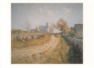
In an unusual collaboration, two Lyme organizations, the Lyme Land Trust and the Friends of Grassy Hill, raised funds to purchase a treasured rural field to preserve it from development. The field lies to the north of the mid-19th century Grassy Hill church. The scene, painted in 1900 by the Lyme artist, Guy Wiggins, conveys the sense of community in this early period. In the quiet of a spring morning, the barns of the farm across the street and the parsonage and its apple orchard to the rear of the church, cluster around the church and the hay field.
Read the entire press release here.
•November, 2006•
Tree Walk with Dr. Glenn Dreyer
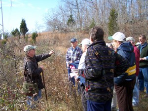 On a warm day in early November, Dr. Glenn Dreyer, Director of the Connecticut College Arboretum, gave walkers some good tips on how to identify trees in the winter, by looking at their overall shape, bark, fruits, and leaf buds (and finding some leaves on the ground nearby never hurts!).
Wetlands Notes
On August 12, Lyme resident Janie Davison welcomed LLT members onto her property at Lord Creek Farm, which provided unbeatable access to the marshes of Lord’s Cove. A small group of canoeists and kayakers followed Janie and LLT director Susan Ballek through the cattails and wild rice, exploring their way up a small creek which ended near Ely’s Ferry Road. It was a beautiful summer afternoon, and plenty of osprey, red-winged blackbirds and belted kingfishers were spotted along the paddle. The marshes in Lord’s Cove have been restored through phragmites abatement and are now completely filled with cattails.
—
A LLT-coordinated phragmites abatement project in Whalebone Creek is nearly complete. There were combinations of mowing and herbicide treatments in 2005 and 2006; follow-up treatments will be made in 2007, if needed. The work was done by All Habitat Services of Madison, CT. A big thank you to the surrounding property owners who sponsored the restoration.
•October, 2006•
Eightmile River Wild and Scenic Coordinating Committee: Fall 2006 Update
By Sue Merrow
Last spring, ten years of effort culminated in the citizens of the three towns of the Eight Mile River watershed: Lyme, Salem and East Haddam, voting overwhelmingly in support of the Watershed Management Plan and Draft Study Report and for seeking federal Wild and Scenic Designation for the Eight Mile River. The U.S. Congress will take up our request for designation in 2007.
Though much has been accomplished, more work remains to be done. Final copies of the Watershed Management Plan and Draft Study Report have been printed and distributed to town halls and libraries. The committee structure has been transformed from the study phase and now reflects the coordination needed for the final phase of the project. The resulting Coordinating Committee is tackling outreach, education, implementation of management tools, science and research. Each of the three towns is moving forward with implementing the Management Plan; East Haddam has adopted riparian overlay protection, an important tool identified in the Plan, and Salem and Lyme are refining their plans for Planning and Zoning consideration. East Haddam also recently voted at Town Meeting to authorize purchase of a critical 117 acre piece of watershed property.
If you would like to become involved, please visit the website or call 860-345-8700. And please go out and enjoy this remarkable and beautiful place right in our backyards.
•September, 2006•
Ravine Trail Hike: A Slice of Tectonic History
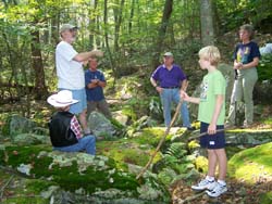 On Saturday, September 9th, former state geologist Ralph Lewis led a group of hikers on the Ravine Trail off Joshuatown Road. This trail cuts through an area that typifies the unique landscape of southeastern New England, east-west trending bedrock ridges cut by north-south fractures.
Unlike other areas of Connecticut, Ralph explained, Southeastern Connecticut was once part of a small continent called Avalonia (440-350 million years ago), which collided with the North American Plate, and through heat and compression, a small crinkle in the bedrock fabric developed east-west rock alignments. The rocks of Avalonia have been pushed under the rocks of the Iapetos Ocean along the east west trending Honey Hill Fault. As the Atlantic Ocean widened, from 200 million years ago to the present, part of Avalonia formed southeastern Connecticut, and another part formed western Morocco. As less resistant rock was eroded by water, ice, and vegetation, stream valleys were formed with south-flowing drainage, as part of the Eight-Mile River watershed. The Ravine Trail is a window into this tectonic history.
•August, 2006•
Pickwick’s Preserve
New Easement Links Joshuatown Road with Mt. Archer Woods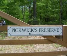
The generous donation to the Lyme Land Trust of a conservation easement from George and Nina Lombardino of Brooklyn, New York and Lyme has made a new trail available to the public. This trail on Pickwick’s Preserve now makes it possible to hike from Joshuatown Road through the Eno Preserve and the town-owned Mt. Archer Woods and Jewett properties to Pleasant Valley trails.
The easement accomplishes three objectives: it adds an important piece to Lyme’s unfragmented open space, it opens an entrance to this space from Joshuatown Road and it serves as a special memorial to the Lombardino’s Shetland sheepdog, who enjoyed rambling this trail with his owners. Other dog owners are especially encouraged to bring their dogs to enjoy this unique property.
The twenty-acre Pickwick’s Preserve is part of a larger area of old pastureland, with diverse tree species including oak, maple, black birch, ash, beech, hickory, blackgum, and tulip poplar trees. The property is within the watershed of Joshua Creek and includes wetlands and several streams that drain into the Creek, providing a diverse habitat for mammals, birds, and amphibians. Together with the abutting 280 acre Mt. Archer Preserve, the Eno Preserve, and other neighboring preserves, a total of over 1,500 acres now forms a contiguous block of protected land.
Pickwick’s Preserve can be reached from the dirt road at #183 Joshuatown Road. There is a parking area about ¼ mile down the dirt road, in front of the “Pickwick’s Preserve”sign. Light blue trail markers indicate the trail beyond the gate. An easy walk of about ½ mile connects with the Red trail in Mt. Archer Woods. The Land Trust is organizing a spring hike along these connecting trails to Pleasant Valley Preserve.
•June, 2006•
Amphibian Study and Collection with Ed Natoli
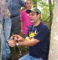 On the evening of June 9th, a small but enthusiastic group set out amphibian traps in several vernal pools in Pleasant Valley under the direction of Dr. Ed Natoli. The data collected was sent to the Peabody Museum in New Haven for their Connecticut Amphibian Monitoring Project, which monitors the health of the population in vernal pools in various areas around the state. The simple traps, made from 2 liter soda bottles, were partly submerged around the edges of the pools and left overnight.
The next morning we collected the bottles at each pool; the captured creatures were tentatively identified and each one of interest was put in a labeled and sealed plastic “baggie”, identified by pool, to send back to the Peabody. Each pool was a little different: at one pool we found mostly tiny tadpoles, tentatively identified as green frogs, at other pools we found tiny salamanders.
At the end of our collection, Dr. Natoli set up a microscope on the hood of his car and we were able to see amazing close-ups of these creatures. One of Dr. Natoli’s students entertained and impressed us with her ability to reach into a pool and capture a green frog barehanded and we were able to all get a wonderful close-up look at a rather unhappy green frog. The Lyme Land Trust is fortunate to have people such as Dr. Natoli willing to take the time to share their extensive knowledge with us. It was a very educational outing and (with the exception of the green frog), a good time was had by all!
•May, 2006•
Dr. Robert Thorson Speaks on Stone Walls of New England
On May 23, Dr. Robert Thorson, Professor of Geology at the University of Connecticut, Hartford Courant columnist, and coordinator of the Stone Wall Initiative, spoke to a standing-room-only audience at the Lyme Public Hall on “Stone Walls of New England: History and Conservation”. “Every stone and every wall has a story,”Dr. Thorson said, “and help the landscape come alive.”Stone walls lend a sense of scale to nature, framing fields and adding an element of classical beauty to our surroundings.
When settlers from the southeast of England reached New England, they found the same rock formations here as those they had left in the old world. New England provided a unique setting for the building of the stone walls that crisscross our landscape today: the area was settled before 1700; agriculture and the raising of livestock were the main occupations in the area; and the geological landscape provided the granite and gneiss slabs that were necessary for wall-building. In fact, Dr. Thorson noted, stonewalls are in many ways the essence of folk art: they are useful, beautiful, rough hewn, and rely on a craft process that is passed down as a cultural tradition. Only one element is missing to make that classification complete: they are not collectible.
Dr. Thorson deplored the recent trend for strip-mining stone walls from this area and sending them out of state, saying that it was leading to a loss of regional identity and was one sign of the increasing homogenization of America. We are trading archaeology for architecture, habitat for decoration, and hands-on education for classrooms, he said, and suggested that abandoned walls should be left alone, and any new wall building should employ quarried stone.
Dr. Thorson has written three books on stone walls: “Stone by Stone: The Magnificent History in New England’s Stone Walls,” which was the winner of the 2003 Connecticut Book Award for Nonfiction, “Exploring Stone Walls: A Field Guide to New England’s Stone Walls,”and the award winning illustrated children’s book, “Stone Wall Secrets.”
The program was co-hosted by the Land Trust and The Lyme Public Hall and supported by the Rufus Barringer Resource Education and Protection Fund.
Rufus Barringer Education Fund Supports New Projects
The Lyme Land Trust has been able to undertake several new and recent projects with the support of the Rufus Barringer Resource Education and Protection Fund. We have developed new signage and a booklet for the Roaring Brook Trail in Hadlyme which opened last year. The Land Trust co-hosted a lecture last month with the Lyme Public Hall by Robert Thorson, professor of geology at the University of Connecticut on “Stone Walls of New England: History and Conservation”. In the works are hats and tote bags with the Lyme Land Trust logo to be given to participants at walks and other events. The Fund will also be funding cartographic mapping of Lyme Land Trust trails for use on our website and in a trail map book.
The Rufus Barringer Fund was set up several years ago by Sharlee Barringer in memory of her husband, a conservationist and former Lyme Land Trust president. Since that time, many contributions have been made by other Land Trust members. We are so pleased to have the work and legacy of Rufus Barringer be continued in the activities supported by the Fund. Thanks to all who have given to the Rufus Barringer Fund.
LLT Members Provide and Repair Osprey Nesting Platforms
Osprey, also called fish hawks, were commonly seen nesting in shoreline trees before the 1960’s, but the use of DDT nearly eradicated them in Connecticut. A ban on the use of DDT and the dedication of those who have erected and monitored nesting platforms have helped restore the osprey population along the Connecticut shoreline. Man-made platforms allow for the use of predator guards which prevent raccoons from climbing up and raiding nests.
Osprey traditionally nested along the Eightmile River and for the last several years they have been seen near Molson Pond, so the Lyme Land Trust decided that a nesting platform should be erected. Moulson Pond Steward, Linda Bireley, obtained funds for the materials from Northeast Utilities, permits from state and local agencies and recruited Jim Morgan to design and pre-assemble the platform on its support pole. Normally, osprey platforms are implanted in solid ground. However the only solid ground around Moulson Pond was too close to the habitat of Great Horned Owls, who prey on nestlings. Thus, it was decided to anchor the platform mid-pond. On August 25, 2005, under Jim’s direction, abutting landowners Jeff and Kathy Rowe and volunteers Ed and Linda Bireley, Betsy Morgan, and Tony Irving ferried the platform to its present site, raised it and secured it. A second, lone pole, called a perch pole, was installed near the new nest platform for the male osprey, which will provide fish to the female while she incubates the eggs. Sue Hessel helped capture the event in pictures.
Unfortunately, this winter’s ice and water flow have forced the platform to lean, but we are encouraged that the force did not topple it. In early spring, another crew will straighten and reinforce the anchor and hopefully a pair of arriving osprey will take up residence. Once again we will be able to enjoy watching these magnificent birds fishing and raising their young.
Many thanks to all who made it possible, especially Jim Morgan
•April, 2006•
Hearty Souls Brave the Rain for Fish
Eleven people braved the rain on April 8th, 2006 to learn more about migratory fish and the Moulson Pond Fishway. Linda Bireley started the second of the Land Trust’s Second Saturday walks by explaining that the fishway had been operating since 1997 and had passed thousands of river herring to reaches of the Eightmile River above the Rathbun Dam where they could spawn. The fishway could also accommodate Atlantic salmon, American shad, various species of trout, sea-lamprey, American eel as well as resident fish. She reported that alewife, one type of river herring, had been seen earlier that week and would be present in the fishway periodically throughout April and May. They would be followed in May and June by blueback, the other type of river herring seen in the Connecticut River and its tributaries. Unfortunately, when the group walked along the fishway, no fish were seen. Since then, however, fishway monitors have reported thousands of fish using the fishway and some fish have been seen spawning upstream of the dam.
•March, 2006•
Lyme Land Trust Receives Awards
At the 23rd Annual Convocation of Connecticut land Trusts held March 25, 2006, at Northeast Utilities’ Corporate Offices in Berlin CT, the Land Trust Service Bureau recognized the Lyme Land Trust with two awards. One was the Award for Excellence in Stewardship for obtaining funding to support repairs and improvements to the Moulson Pond Fishway. The second was the Public Participation Award made to the East Haddam Land Trust, the Salem Land Trust and the Lyme Land Trust for their efforts to inform and turn out voters in recent municipal referenda that approved Congressional Wild and Scenic designation for the Eightmile River Watershed. Well over 700 voters turned out and 93% voted in favor of designation.
Lyme Land Trust Photo Contest Winners!
The Lyme Land Trust, Inc. and the Old Lyme Conservation Trust, Inc. are pleased to announce the winners of their jointly sponsored amateur photo contest. The purpose of the contest was to focus on the celebrated and scenic Lyme-Old Lyme countryside. There were over 260 photos submitted from photographers all over Connecticut and from as far away as Ohio and Wisconsin. The ages of the photographers were from 7 to 80.
•February, 2006•
Lyme Land Preservation Workshop
There was a land preservation workshop held on the 18th. A summary can be read here. Emily Lerner, a board member, also wrote this first in a series about Lyme farmland.
Eightmile River Protection Strongly Backed By Local Residents
In early February 2006, citizens at a packed town hall meeting in Salem voted overwhelmingly to endorse a proposed management plan to protect the Eightmile River watershed and to seek designation for it as a national Wild and Scenic River. The vote was the culmination of an intense effort by the Eightmile River Study Committee, local conservation organizations, and concerned citizens to demonstrate public support for proactive watershed management in the three towns that fall within the watershed’s borders: East Haddam, Lyme, and Salem.
The successful town votes also culminated a three-year Congressionally-authorized study of the watershed, and a decade-long effort by local citizens and government leaders to focus attention on what Eightmile River Study Committee Chairman Tony Irving refers to as “this exceptional natural and cultural resource.”
“The study determined that the Eightmile River was eligible for inclusion in the National Wild and Scenic Rivers System by showing what makes it unique and worth protecting,”said Irving, a Lyme resident. “We focused on issues relating to water quality, geology, unique species, cultural resources, and the river system as an intact, naturally functioning watershed system. The management plan we have drafted for the watershed is one that will keep our communities in charge in charge of determining the Eightmile’s future.”
East Haddam resident and former First Selectman Sue Merrow said she was gratified by the level of public support shown for the Eightmile management plan. “It was one of the larger town meetings in recent memory, and when Senator Chris Dodd (an East Haddam resident) showed up to vote in support in support bof the plan I knew we’d done a good job of getting the word out!”
The Eightmile project now enters the legislative area in Washington for Congressional action. U.S. Representative Rob Simmons, whose Congressional district includes the towns of East Haddam, Lyme, and Salem, has indicated he will introduce legislation in the near future to secure Wild and Scenic status for the Eightmile. The designation would provide the financial and personnel resources necessary to implement the river management plan.
The Eightmile project has been a wonderful success, but the story is far from over. In the months ahead, citizens will continue to have an opportunity to speak out in their communities and to their representatives in Washington in support of protection for the Eightmile. For additional information and the latest updates, visit the Eightmile River website, or contact Eightmile River Study Coordinator Damon Hearne at 860-345-2406
At each of the three town hall meetings the motion to endorse the Eightmile management plan and seek national Wild and Scenic designation passed by margins of 90% or more. The few opponents present questioned the involvement of the federal government in the project and whether there truly existed a need for regulations covering the watershed. In comments made at the East Haddam meeting and to reporters, Study Chairman Irving stressed that the proposed management plan does not create new federal mandates or regulatory powers. The plan is a set of recommended, not mandatory guidelines that the three towns may implement as they see fit. Wild and Scenic designations have helped other New England communities, Irving said, and the benefits to resource protection and quality of life can be very significant.
•January, 2006•
Lyme Town Voters Support the Protection for the Eightmile River
On Friday, January 13, over 300 town residents came to a special town meeting at the Lyme Consolidated School to vote on the future of the Eightmile River. Residents were asked to consider two issues: first, a management plan for the Eightmile River watershed and second, a recommendation to seek national Wild and Scenic Designation for the river. Both proposals passed by a voice vote of an approximately 95% to 5% margin.
The management plan and proposal for designation were produced by the Eightmile River Wild and Scenic Study Committee. The Study Committee has spent three years conducting a scientifically-based research study of the watershed. For more information on the study of the river and the full text of the management plan, visit the Eight-Mile River Website.
The citizens of East Haddam will vote on the management plan and proposal for designation on Jan. 23 and residents of Salem on Feb. 1. If the citizens of all three towns vote in support of designation, the final step in protecting the Eightmile River will involve seeking Wild and Scenic Designation by an act of the U.S. Congress.

